
AR You can try it
A lab in your pocket
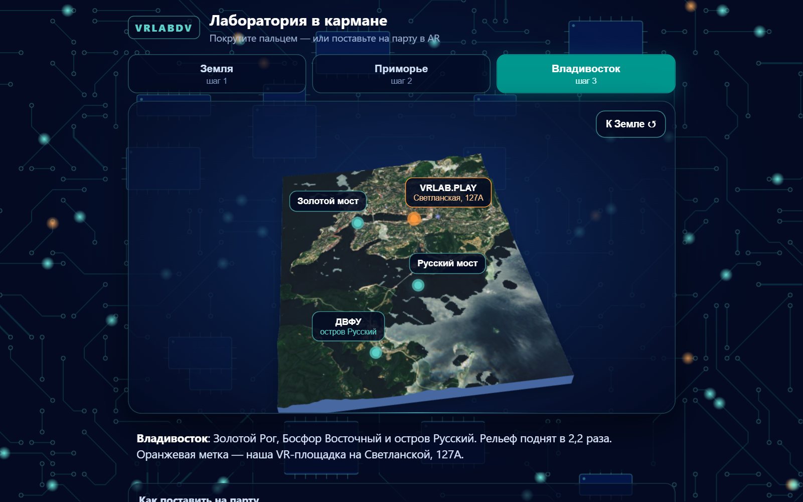
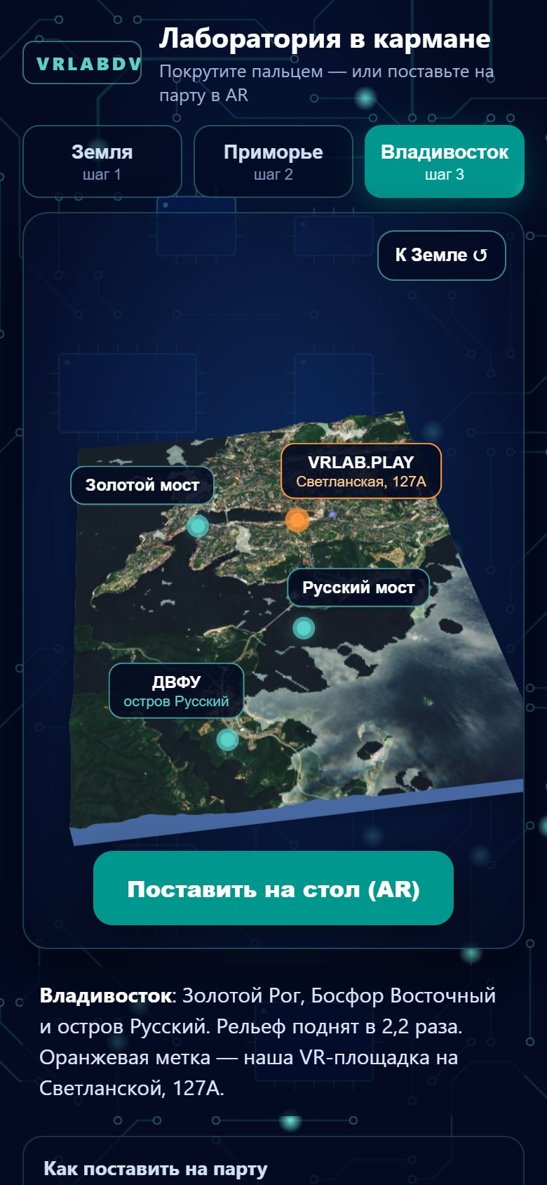
A web page that puts a relief model of the Earth, then our region, then our city on the desk in front of you, through your phone's camera. No app to install.
We made it for a room full of teachers in Norilsk, at a forum on how VR and AI can be used in a classroom. Talking about augmented reality to people who have never held it is useless. So the plan was simple: everyone in the room gets a link, points a phone at the desk, and a mountain range appears on it.
Three steps down
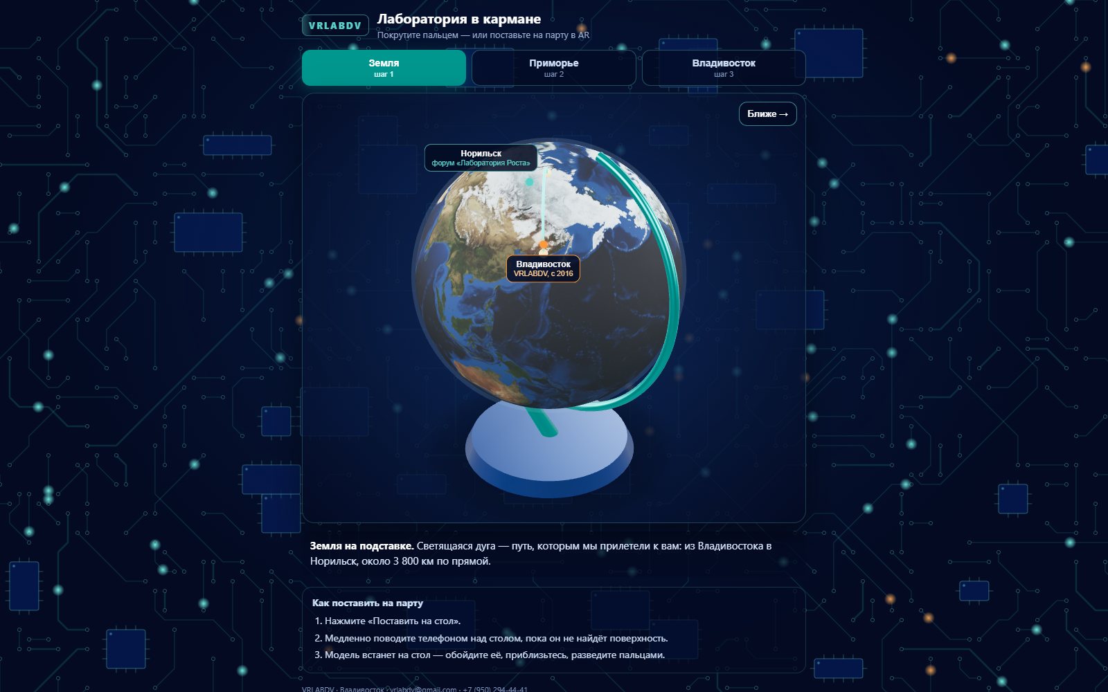
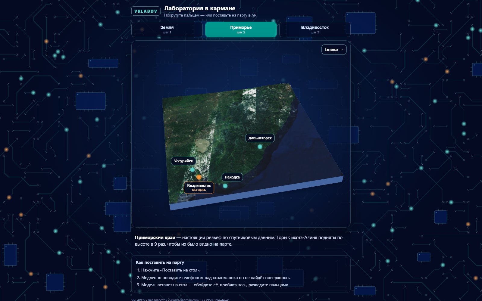
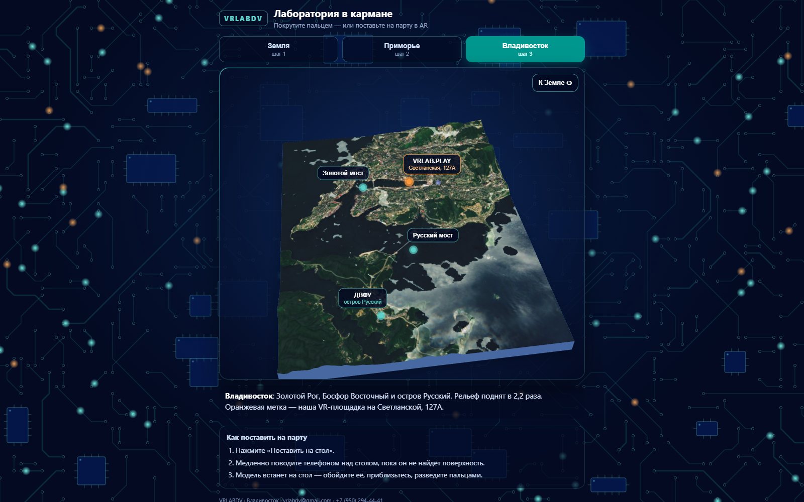
It starts with a desk globe. A glowing arc on it shows the flight we took to get to the room. Press "Closer" and the globe becomes Primorye, our corner of the Russian Far East, built from real satellite relief. Press again and it is Vladivostok, with the Golden Horn, the bridges and the island.
On a phone, one button puts the model on the table. Move the phone slowly until it finds the surface, and then walk around it, lean in, or pinch to make it bigger. On a computer it is a model you turn with the mouse.
What we learned
- Mountains at true height are invisible on a desk. Primorye's are stretched nine times, the city's a little over two, and it still reads as the real place.
- A link beats an app. Nobody in a forum hall will install anything, but everyone will tap a link.
- The phone already knows how to do this. Android and iPhone both have a built-in AR viewer; the page only has to hand them a model.
- Three steps is a story. One model is a demo.
Where this goes
The fire maps of AeroFire Command and the estates of Souls & Estates are already small landscapes. Both would sit well on a kitchen table. That is the experiment after this one.
Pictures
Talk about this one
Questions, ideas, “you should try this instead”: the thread for this experiment is open to anyone.
The forum runs on GitHub Discussions. Reading is open to all; posting needs a free GitHub account.
More experiments
 Robots · Tools
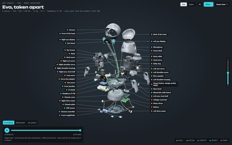
Eva and Adam, taken apart
Two humanoid robots live in our workshop. We write the software that makes one of them see, listen and pull faces, and we built a 3D guide that takes both of them apart screw by screw.
In progress
 Art direction
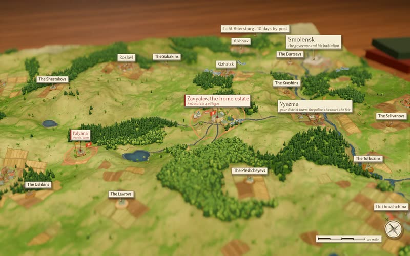
One wheel, four tables
In Souls & Estates one mouse wheel now takes you from a single peasant yard to a table map of central Russia, through four dioramas of the same place.
You can try it
 New platform
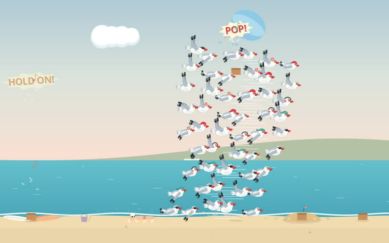
A game inside a Reddit post
What if you did not have to leave the feed to play? We put Gull Chorus, our seagull flock game, inside a Reddit post: one post is one beach, with a leaderboard under it.
In progress